


Hello Interactors,
Today I’m wrapping up this April series on the role large scale surveying played in determining how people of the United States of America interact with each other and the government. Jefferson had a vision for the country that combined his desire for agrarian expansion west, tax revenue for building a world dominating military, and his fascination with astronomical, nautical, and terrestrial mapping.
As interactors, you’re special individuals self-selected to be a part of an evolutionary journey. You’re also members of an attentive community so I welcome your participation.
Please leave your comments below or email me directly.
Now let’s go…
PLUNDER THE BLUNDERER
The 2020 United States Presidential election had its fair share of electoral college drama, but nothing like the election of 1800. Thomas Jefferson was running against the incumbent John Adams to become the first non-Federalist President. It ended in an electoral college tie. To make matters worse, a flaw in the Constitution meant the run-off was between the top two vote getters. Back then, voters could vote for both the position of President and Vice President independently. Jefferson and his Vice Presidential candidate, Aaron Burr, each tied with 73 electoral college votes. Adams only had 65 and his running mate 64. The decision on who should be president, Jefferson or Burr, fell to the House of Representatives. Hamilton, a Federalist and no friend of Jefferson, detested Burr even more and lobbied in the background with other Federalist representatives to elect Jefferson. It worked. Jefferson became the United States’ third president and the first Democratic-Republican in February of 1801. Two years later, in 1803, Jefferson turned his attention toward another Federalist – the Surveyor General, Rufus Putnam.
I mentioned Putnam in last week’s post when he became the United States’ first Surveyor General in 1796. He was appointed by George Washington under whom he served as Colonel and Chief Engineer in the Revolutionary war. He was also the founder of the Ohio Company of Associates – the ‘associates’ were his Revolutionary War buddies. The land he was asked to survey was the very land from which his company would profit.
Jefferson, the mastermind behind the methodical gridding of land for taxation and expansion, wasn’t happy with Putnam’s work. He felt the surveys were rushed, inexact, and that Putnam was passed his prime. At 64 years old, Jefferson found Putnam to be too “set in his ways”.1 It was time for a new Survey General. Jefferson’s feelings for Putnam are clear in his offer letter to his replacement:
“Sir
You will be sensible of the reasons why the subject of this letter is desired to be entirely confidential for a time. Mr. Putnam the present Surveyor General in the Northern quarter is totally incompetent to the office he holds.
…it has cost Congress a great deal of time…and the removal of the blunderer has been sorely and generally desired…
…I am happy in possessing satisfactory proof of your being entirely master of this subject, and therefore in proposing to you to undertake the office…it is important to have an immediate change or we shall have the same blunders continued.”2
Putnam’s replacement would be Jared Mansfield. He was just the man Jefferson needed. Mansfield was a mathematician who was skilled at using astronomy to perfect his surveying. He attended Yale in 1773, but after the death of his father became delinquent. He was accused of stealing books from the Yale library and was expelled. He landed a series of teaching jobs at small grammar schools in Connecticut, but was welcomed back to Yale. In 1787 he was awarded his degree with his original classmates.
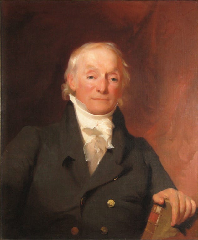
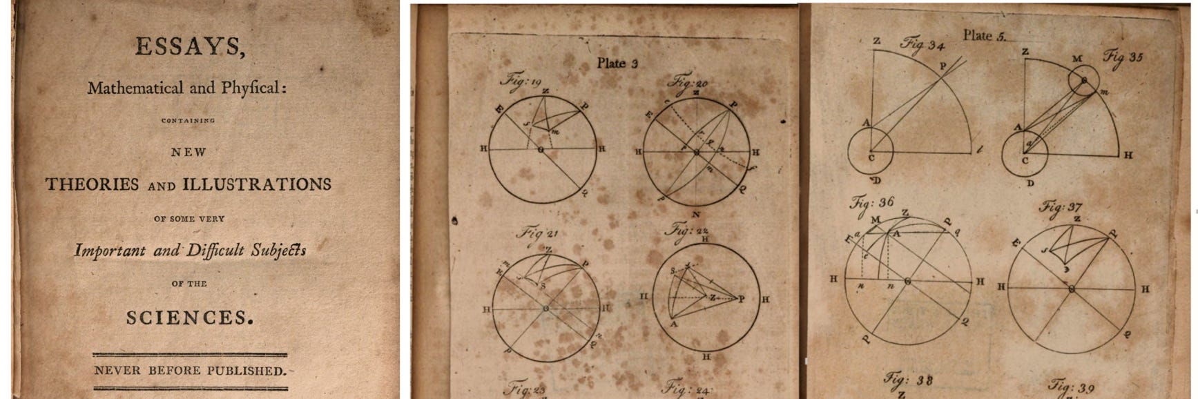
In 1801 Mansfield published what may be the first piece of original mathematical research from an American in a collection of essays entitled, Mathematical and Physical. It covered topics in algebra, geometry, Newtonian fluxions, and nautical astronomy. The paper caught Jefferson’s attention and he appointed Mansfield to be Professor of Mathematics at West Point Military Academy. Two years later, in July of 1803, he became Surveyor General replacing the ‘blunderer’ Rufus Putnam.
MANSFEILD, MEIGS, AND TIFFIN’S TENSION
Finally Jefferson had a surveyor he could trust. Mansfield set out from New Haven, Connecticut to Marietta, Ohio with a plan. While he knew it was impossible to correct all the errors of previous surveys, he was clear that moving forward all surveys had to be conducted as he instructed. Given his position of Surveyor General also came with the title of Army Lieutenant Colonel, he was in a position to make demands.
Eight months later the Congressional Act of March 26, 1804 came into effect. This was not only the first act passed under the direction of Mansfield, but it granted him authority to extend surveying into new territories in “which Indian title had been extinguished or" shall hereafter be extinguished.” (1) It was clear the U.S. Government was intent on grabbing up Indigenous land either by treaty or by force.
Section 13 of the Congressional act of 1804 solidifies Mansfield’s authority by making it law.
“Sec . 13. And be it further enacted, That whenever any of the public lands shall have been surveyed in the manner directed by law...”.(1)
By 1804 Mansfield had documented the prescribed process in his Plan of Instructions for the District Surveyors. This is the first known written account of surveying instructions that eventually became what is known as the Manual of Surveying Instructions. Here you can read an 1855 version of that same manual. And while surveying technology has advanced, even the most recent version from 2009 contains the same purpose, scope, and technique as the original. Mansfield continued as Surveyor General until 1812 executing precision surveys with his team of deputy surveyors.
He was replaced by Josiah Meigs, but then Meigs swapped jobs two years later with Edward Tiffin who was the Commissioner of the General Land Office. Tiffin was schooled in medicine and then became a politician, but he turned out to be as skilled at surveying as Mansfield. He remained the Surveyor General for the next 14 years. He expanded on Mansfield’s instructions making them even more accurate and complete.
As the U.S. Government continued to gobble up land marching west, Tiffin had a hard time keeping up. Conflicts began to emerge between state and federally operated surveys and confusion and frustration mounted.
Tension also continued to grow between Indigenous nations and the United States. Between the country’s founding in 1776 and 1827, the United States instigated, or were involved in, ten different wars against other nations – mostly Indigenous nations. Another eleven were to follow as the Civil War approached. Friction also grew among competing White settlers during the 1820’s marking the end of unity among religious denominations and ethnicities who had banded together to survive. Even those rugged individualist pioneer settlers, many of whom found ways to coexist with Indigenous people, gave in to federal demands for land and were forced to pay taxes.
By 1829 Tiffin’s health was suffering and he was asked to step down on May 26, 1829. He passed away a little more than a month later on August 9th in his home in Chillicothe, Ohio. Then, five months later, Jared Mansfield also passed away. Though he was also living in Ohio, he passed away at age 70 during a trip back to his childhood home, New Haven, Connecticut. These two men remain legends of surveying. They contributed the bulk of the intellectual and physical contributions to realizing the vision Jefferson had set for the country 45 years prior.
IOWA: A PLACE TO GROW
In 1836 land sales by the United States government reached an all-time high of 25 million dollars, an equivalent of $712M today. States were beginning to fall into debt from infrastructure projects. But it didn’t stop people from continuing to settle land. Instead of waiting for the government to survey ‘newly discovered’ land, settlers invented their own means of squaring a chunk of property. Here’s how one pioneering farmer in my home state of Iowa described it:
“The absence of section lines rendered it necessary to take the sun at noon [to find north-south] and at evening [to find east-west] as a guide by which to run these claim lines. So many steps each way [800 double paces by 1,600] counted three hundred and twenty acres, more or less the legal area of a claim. It may readily be supposed that these lines were far from correct, but they answered all the necessary claim purposes for it was understood among the settlers that when land came to be surveyed and entered, all inequalities would be put right [by adding or subtracting land].”3

When the U.S. began selling land in quarter acre lots, it became even easier to plat your own land. Squatters would simply head out at noon, take 250 steps toward the sun and jam a stick in the ground. Then, in the evening, as the sun was setting, they’d walk another 250 steps and plant another marker aligned to a point on the horizon where the sun had just dipped down. As Linklater Andro points out in his book, Measuring America:
“Even Jefferson would have approved; no system of measurement could have been more transparent, more democratic, more suited to “the calculation of everyone who possesses the first elements of arithmetic.” It was so straightforward that the citizen squatter could operate it as easily as the government surveyor.” (3)
With these two points anybody could construct a square that measured 440 yards by 440 yards completing a 40 acre lot. This was the amount of land the government had decided an average family would need to settle. It’s a unit of measurement that came to dictate so much of our economy, culture, and mythology. Growing up in Iowa, ‘Back 40’ was an idiom used to describe the far off corner of farm land; as in, “Where’s Jeff? He’s out plowin’ the Back 40.” The irrigation systems you see flying over America’s farmlands are built to encircle a 40 acre square. “40 acres and a mule” is what General Sherman ordered his army to lend to freed slaves in 1865. And before Zip Codes, mail was delivered to plat numbers inside townships: “Township 22 North, Range 4 West, Fifth Principal Meridian.”
Government surveyors found it tedious and cumbersome to measure in relatively small 40 acre increments. But it was so easy, anyone could do it. This clearly accelerated the pace of settlement across the nation. From 1800 to 1830 the U.S. government had gone from selling 300,000 acres a year to over one million. But as those Iowa squatters were counting their steps in the 1830’s things really took off. By 1837 fifty-seven million acres were sold or over eight million acres a year – an eight-fold increase in just seven years.
A SQUARE DEAL
Back in the late 1700’s Alexander Hamilton may have envisioned companies gobbling up large swaths of land for profit, but it was Thomas Jefferson’s vision of ordinary White folks seeking fame, fortune, and farming who were the victors. Both super-speculators and small-town squatters profited from land speculation – or capitalism – as speculation was called in the nineteenth century.(3) And by 1838 there was a new source of money that was more attractive than land for both the U.S. government and would-be capitalists – California gold.
Little changed with the United States’ Public Land Surveying System throughout the rest of the 1800s. But the allure of the edge of wilderness continued to beckoned people from foreign lands who had no hope of such claims in their own countries. It wasn’t for the faint of heart, but it’s easy to see how any enterprising individualist would be attracted to the prospect of property under the protection of a burgeoning democratic empire. Not just any empire, but one that made it easy for anyone to map out their own home. Just wander out into a grassy field at lunch time, look to the sky, walk toward the sun, plant a stake, and then do it again at dinner time. That’s all it took to make a square alongside your neighbor’s square. Squares that made a grid across a vast undulating terrain at the cost and pain of the Indigenous nations that remain. A grid that continues to also meticulously measure people, politics, taxes, and grain.

C. Albert White. A History of the Rectangular Survey System.
Linklater Andro. Measuring America.


Make Your Own Survey in Under a Day